
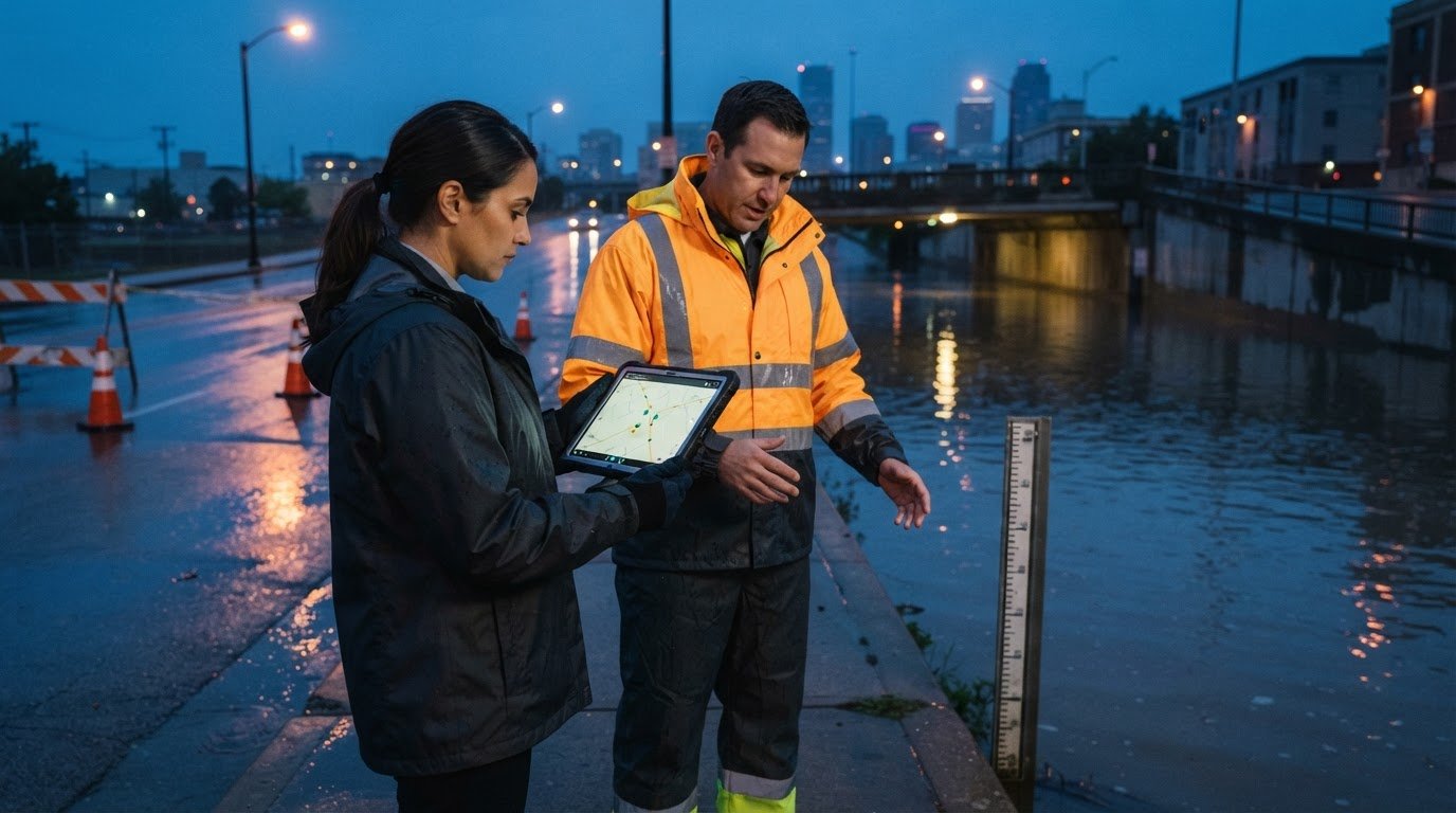
Field teams need more than a map dot to make sound decisions. Mobile situational awareness for field operations brings together real-time information, context, and a view of how conditions may change. A shared operational picture helps field personnel and command teams work from the same information as events develop.
When updates are scattered across apps, messages, and systems, teams can lose time piecing together the picture before they act. Mobile tools can connect locations, photos, status updates, environmental information, and operational assets. Command can see what field teams report, while responders stay aligned as priorities change.
This article explains what situational awareness means in practice and how mobile tools support communication between field teams and command. It also covers how maps, dashboards, and integrated data create a common operating picture, and what makes that picture useful: relevant information, clear context, and updates that help people decide what to do next.
Key Takeaways
- Understand how situational awareness turns incoming information into context teams can use to make decisions.
- See how field updates, images, and status reports can keep command teams aligned as conditions change.
- Learn how environmental data from sensors, cameras, and personnel can add useful context to operations.
- Explore how visibility into connected assets can support coordination and help teams avoid duplicated effort.
- Discover how maps and dashboards can bring operational information together in a shared picture.
What Is a Common Operating Picture in Emergency Response?
A common operating picture brings current incident information into a shared view for field teams and command. In emergency response, it helps people interpret conditions, understand their implications, and anticipate what may happen next.
Incident and Event Awareness
Situational awareness combines information about the environment, comprehension of the situation, and projections of future conditions. During a wildfire, for example, a forecast can help firefighters assess where to establish control lines. In a HAZMAT response, weather predictions can help unified command define potential fume parameters.
That context supports decisions about where to position people and resources, and what to prioritize as an incident changes. Disease projections offer another example: COVID-19 transmission history and forecasts can help planners anticipate healthcare response needs. A common operating picture gives incident teams a way to view relevant information together, rather than making decisions from isolated updates.
How do mobile situational awareness platforms compare in features and pricing? Compare whether each platform can bring operational data, field reports, locations, and status updates into a useful shared picture. Costs depend on the software and hardware scope, so there is no single typical price that applies across platforms.
What is mobile situational awareness for field operations? It connects information from responders and operational sources in a shared view that supports decisions in the field and at command. Its value depends on whether updates provide timely context, such as a crew’s location alongside changing weather conditions.
Responder, Asset, and Facility Status
Location and status information shows where emergency personnel, assets, and facilities are operating. A map can help command see which teams are near an incident, where equipment is positioned, and which facilities may support the response. Field personnel can contribute location data, photos, and status updates for command to view.
That shared view helps teams coordinate deployments, identify changing needs, and reduce duplicated effort across agencies. Seeing where another agency is operating, for example, can inform resource assignments before a second team is sent to the same area. Facility location and status also provide context when command assesses available support.
What are typical costs for mobile situational awareness software and hardware? The price depends on the case and is given after a quote request; factors include the software scope, hardware requirements, and integrations. A common operating picture may appear on mobile devices and computers using the same data, helping field teams and command work from an aligned view as conditions change.
Communication between field teams and the security operations center
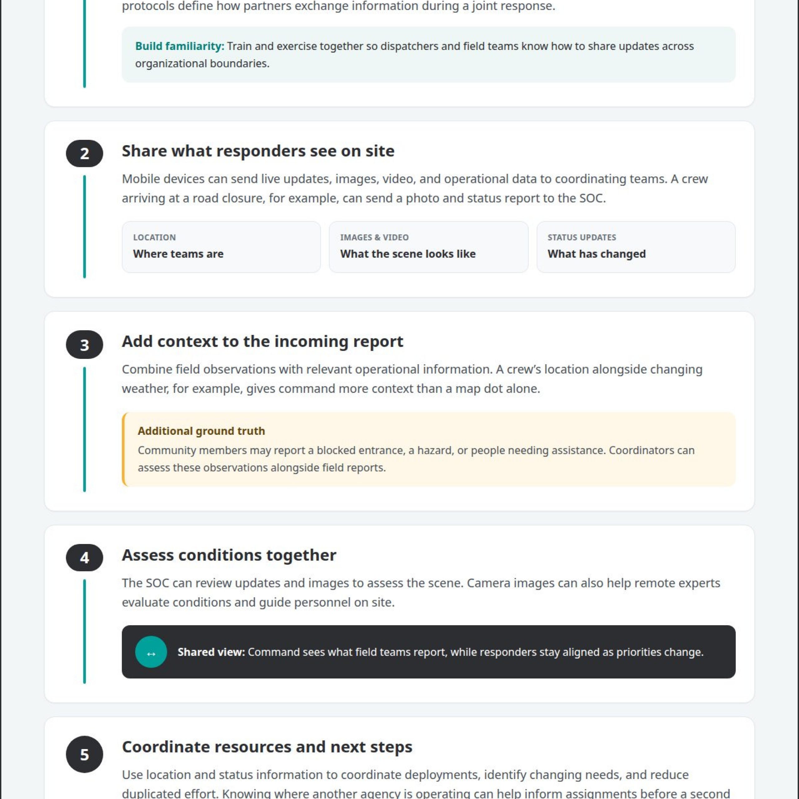
Communication links field personnel with the security operations center (SOC) as an incident develops. Responders can use mobile devices to share live updates, images, video, and operational data with coordinating teams. For example, a crew arriving at a road closure can send a photo and status report, helping the SOC assess conditions without relying on a voice description alone.
That exchange puts field observations in context. Camera images can help remote experts assess a scene and guide personnel on site. Immediate access to relevant information on responders’ devices can also reduce calls to the communication center, leaving those calls for urgent decisions rather than routine status checks.
Multi-agency coordination depends on agreed communication procedures established before an incident. Mutual aid agreements and data-sharing protocols set out how partners exchange information during a joint response. Agencies can also train and exercise together so dispatchers and field teams know how to share updates across organizational boundaries. During a wildfire, coordinated reports about team positions and road access can help partners avoid duplicated assignments.
Community input can add ground truth that agency systems may not capture. Someone near an incident may report a blocked entrance, a hazard, or people needing assistance. Coordinators can assess that information alongside field reports for additional context. Clear processes for receiving and sharing community updates help teams distinguish actionable observations from unrelated messages.
Security is part of effective communication. Public safety mobile platforms should use AES-256 end-to-end encryption. Access controls and defined data-sharing protocols also help keep sensitive incident information available to appropriate personnel. These safeguards matter when teams exchange location details, images, or operational instructions across agencies.
How do mobile situational awareness apps work offline in remote areas? Where connectivity is limited or unavailable, edge computing can let teams collect, analyze, and prioritize information on site without waiting for a connection to a centralized cloud. This supports local decision-making, but disconnected devices cannot provide live updates to the SOC until communication is restored.
For operations that need field updates connected with command-center coordination, public safety situational awareness provides relevant context on how teams can bring operational information together.
Environmental information from sensors, systems, people, and cameras
Environmental awareness combines observations from sensors, cameras, connected systems, and field personnel. Each source describes a different part of the operating environment: a sensor may report a changing condition, while a field member adds context. A camera can show the scene, and a GIS map can place it geographically. Together, these sources help coordinators interpret information before choosing an action. Comparing an alert with nearby reports, camera views, and team updates gives decision-makers a fuller basis for assessing the situation.
Mobile mapping camera data can support the creation of 3D models of an area. Reality capture uses technologies such as 3D scanning, photogrammetry, and LiDAR to create digital representations of the real world. A model can help teams identify potential hazards, plan routes, and analyze their surroundings. For example, a response team assessing an unfamiliar site can use mapped features to understand how an obstacle may affect access. This spatial context adds a different kind of information than a live camera view alone.
Effective action depends on organizing information around the incident, not simply collecting more feeds. An operational view might place a sensor reading beside a camera image and a field report. Personnel can assess whether the sources describe the same condition or separate events. Apps can organize relevant information to support rapid decisions and coordinated activity. This distinction matters: irrelevant data and unstructured alerts can fatigue workers and obscure the task at hand.
Information security also shapes how teams use environmental data. Public safety mobile platforms should meet CJIS compliance requirements. Agencies can configure access permissions, update them as needed, and define who may view or contribute information from particular operational systems. These controls help teams share incident details with appropriate personnel while protecting sensitive operational data from unintended users.
Consider a response near a busy work zone. A roadside camera may show a blocked approach, while a field report describes the obstruction and a connected system provides additional context. When these sources appear together, coordinators can assess what needs attention and prioritize a response. A map shows where the observation occurred, while the report records what personnel saw on the ground. Connecting sources into useful context helps teams act on relevant information instead of sorting through disconnected alerts.
IoT-connected assets and real-time operational visibility
IoT-connected devices can help command teams maintain visibility across distributed operations. Fleet trackers, sensors, cameras, emergency facilities, and field personnel can contribute to a shared operational picture. Each source offers a different signal: a tracker indicates where an asset is operating, while personnel can report its current status. Together, these inputs help command understand what resources are available and where teams are working.
That visibility can improve coordination across agencies. Seeing where other agencies are operating can help teams organize assignments and avoid duplicated effort or wasted resources. During a large public event, for example, information about agency activity and vehicle locations can help command assess coverage across the operating area and decide where to position resources as conditions shift.
Real-time access to relevant information also changes how field personnel coordinate. Mobile devices can give responders operational details directly, reducing calls to the communication center for information already available to them. Teams can use those details to understand the current plan, while command tracks field activity and updates priorities. The key is to present information that supports each task, not every available feed to every user.
Training and exercises help teams test whether a common operating picture supports real decisions. In a joint exercise, participants can assess whether asset locations, personnel updates, and facility information give command a usable view. They can also practice how updates move between field teams and coordination staff. This reveals gaps in data sharing or procedures before an actual emergency requires teams to coordinate under pressure.
After an operation, teams can review collected information to assess their response and identify improvements. Comparing reported asset positions with the sequence of operational updates, for instance, can clarify where coordination worked and where information arrived too late. The findings can inform future multi-agency exercises and operational planning, as well as help teams refine which information should reach field devices and command personnel.
Real-time visibility is useful only when teams can interpret and act on the information. A fleet tracker alone shows an asset’s position, not whether command should redirect it. Pairing that position with operational needs and personnel updates gives decision-makers more context. Teams can then prioritize deployments, coordinate vehicle movements, and adjust assignments as the situation develops. A well-maintained common picture connects devices and operational activity to decisions, while exercises and after-action reviews help keep it relevant.
Common operating pictures, dashboards, and maps
A common operating picture makes selected operational information easier to interpret across dashboards and maps. Its value depends on showing relevant details in context, so teams can identify changes and decide what needs attention.
Dashboards and Operational Maps
A dashboard organizes operational information, while a map places selected details in geographic context. Together, they can reveal patterns that separate feeds conceal. A map might display information by weather conditions or neighboring jurisdictions, while a dashboard summarizes relevant activity over time. This shared view gives decision-makers a clearer basis for prioritizing action.
Traffic is one practical application. Real-time traffic updates can help responders identify congestion or roadblocks and choose a faster route. A map can show those conditions alongside locations and operational information relevant to the response. In construction, maps created from mobile mapping cameras can help teams assess whether project activity is progressing according to plan.
Field Platform Features
A field operations situational awareness platform should organize relevant information, combine data in dashboards and maps, and make the same operating picture accessible on mobile devices and computers. These capabilities help field teams and command use shared information instead of relying on separate views.
Useful capabilities also include presenting information over time and filtering it by operational criteria. Law enforcement, for example, may adjust patrols based on hot spot trends and crime predictions. Field teams can view relevant updates on a smartphone while command reviews the broader picture. The platform should make immediate information easy to interpret, not bury the next action in unrelated data.
Maps and dashboards help teams connect local observations with wider operational patterns. An update in one part of a network may matter to nearby jurisdictions or teams working elsewhere. When information is organized by location and criteria, command can see whether an issue is isolated or affects a broader area. That context supports more deliberate coordination than a stream of disconnected alerts.
Instant access alone doesn’t make a common picture useful. Teams need information presented in a way that supports their roles, whether they’re reviewing traffic on a smartphone or assessing operational trends on a computer. Different users may need different views of the same underlying information. A responder needs details for immediate field decisions; command needs enough context to coordinate activity across the operation.
The practical test is whether the display helps people move from information to a decision. A traffic map should clarify route conditions, a trend dashboard should make changes visible, and a shared picture should help teams coordinate across locations. Explore common operating picture capabilities to see how connected operational information can be organized for teams.
Activu Corporation: Event-Driven Situational Awareness
Activu Corporation addresses fragmented systems, information silos, and the lack of automatic escalation with Event-Driven Situational Awareness. Many control rooms already have screens. The missing piece is often the layer that determines what appears on them and automatically escalates information when something needs attention.
The vis/ability Platform serves as a central hub, bringing connected applications and operational information together. This operational intelligence layer surfaces information through the video wall. Teams can access the shared operational picture in command centers, remote locations, conference rooms, breakout rooms, huddle rooms, and on mobile devices through Mobile vis/ability.
For a conversation about coordinating field teams and command operations, contact Activu Corporation.
Set the Next Operational Picture in Motion
Start by identifying where information handoffs slow decisions: between field personnel and command, across separate systems, or when priorities change. Use those gaps to determine how mobile situational awareness for field operations should support your teams, from the information they need to when they need it.
Activu Corporation brings together Event-Driven Situational Awareness, the vis/ability Platform, and Video Wall Systems to support coordinated operational visibility. The right configuration reflects how your teams work across command and field locations, and how information needs to move between them.
Discuss your operational requirements and the picture your teams need to act with greater clarity. Contact Activu Corporation to start the conversation. A clearer operational picture begins with a focused next step.
Frequently Asked Questions
What is situational awareness?
Situational awareness means understanding current conditions, interpreting their significance, and anticipating how they may change. In practice, mobile situational awareness for field operations connects responder reports with the context needed to make sense of an incident. A road closure report, for example, becomes more useful when teams can relate it to access routes and current assignments. This information informs decisions; it does not replace operational judgment.
Which GPS, mapping, and location-sharing capabilities are used in field operations?
Mobile GPS can show responder locations on digital maps alongside incident areas and operational assets. Location sharing gives command context for assigning personnel and coordinating movement. An updated crew position, for example, can help dispatch identify which team is closest to a newly reported site. Maps are most useful when they connect location details to operational information, rather than showing coordinates without explaining their relevance.
How do teams securely share real-time field data and incident reports?
Teams share updates through operational systems that manage access and support agreed data-sharing protocols. A responder might submit a photo and a concise incident report, while designated staff review and distribute relevant details. Public safety mobile platforms should use AES-256 end-to-end encryption. Agencies also need clear permissions for who can view or contribute information, especially when reports involve sensitive locations or interagency coordination.
What devices and connectivity are required for mobile situational awareness?
Responders can use smartphones, while command personnel access shared operational information from computers. Exchanging updates with remote teams and systems requires connectivity. Where service is weak or unavailable, edge computing can let teams collect, analyze, and prioritize data locally. For mobile situational awareness for field operations, teams should understand which information remains available on site and what must wait for connectivity.
What cybersecurity and privacy risks affect field situational awareness systems?
Location details, incident reports, and camera images can expose sensitive operational information if access is too broad or permissions are outdated. Organizations can reduce exposure by assigning access according to roles, reviewing permissions when responsibilities change, and defining what partners may receive. Consider both the data collected and who needs it for their duties, so sharing supports operations without unnecessary disclosure.
How can an organization implement and train staff on a mobile situational awareness system?
Start by defining what field personnel and command need to exchange, then establish access rules and partner-sharing protocols. Use joint exercises to practice reporting, reviewing, and acting on operational updates. After each exercise or operation, review collected information to identify coordination gaps and adjust procedures. This cycle builds staff familiarity with the system and keeps its use aligned with operational needs.
How do leading mobile situational awareness platforms compare in features and pricing?
Compare whether each platform brings operational data, field reports, locations, and status updates into a useful shared picture. Pricing depends on the software and hardware scope, so there is no single typical cost.